
Lee County, Iowa
Pioneer Trail Memorial Pavilion
Lee County played an important part in Mormon history, both before and after the exodus from Nauvoo to Utah. To commemorate the historical events in Lee County the Mormon Historic Sites Foundation has erected three interpretive panels at historical locations in Lee County. The National Park Service has erected a pavilion with interpretive panels in Linger Longer Roadside Park. The Mormon Pioneer National Historic Trail, the first of its kind developed by the National Park Service, begins its Iowa leg at Montrose, across the river from Nauvoo.
Between 1933 and 1940 the Civilian Conservation Corps of the Iowa Conservation Committee erected wooden markers that approximated the route of the Mormons. In 1972 the Mormon Pioneer Trail Foundation replaced most of these signs with the approximately one hundred blue and white metal road signs across the state. Many of these 1972 road signs have been replaced by brown and white National Park Service Mormon Pioneer National Historic Trail signs.
The following are significant Mormon sites in Lee County and are arranged in general chronological order:
Fort Des Moines, 1834 -1837
Following the Black Hawk War of 1832, Iowa was opened to permanent settlement by whites. In order to establish a presence in the territory several companies of a U.S. dragoons (the cavalry of the early 1800s) built the first Fort Des Moines along the banks of the Mississippi River. As settlers moved in, the dragoons were not needed for peacekeeping and in 1837 they were transferred to Fort Leavenworth and Fort Des Moines was abandoned. The fort became a temporary refuge in the winter of 1838-39 for about 40 refugee Mormon families who had been driven out of Missouri. When the Mormons left Nauvoo in 1846, most of the Mormons of Lee County went west. The old fort gradually disintegrated. When the dam at Keokuk was completed in 1913, the river level rose about twelve feet, and the shoreline receded about fifty yards. The original site of the fort is now covered by water.
An interpretive panel about the first Fort Des Moines is one of two located in Riverview Park in Montrose. A bronze plaque set in a boulder at the south end of the little park was erected in 1923 by the Montrose Womans Civic Club.
Mormon Sojourn in Lee County, 1839 - 1846
In January 1839, the barracks of the abandoned Fort Des Moines that had once quartered 180 soldiers now provided shelter for about 40 Mormon refugee families from Missouri, led by Israel Barlow. The families of Brigham Young, John Taylor, and Wilford Woodruff, all future presidents of the Church, were among those taking rooms in the barracks. Based on information provided by Barlow the Mormon Church purchased twenty thousand acres stretching westward from the village of Montrose that grew up around the fort. In 1841 Joseph Smith declared that it was now time to build Zarahemla, a new town adjacent and just west of Montrose. Thirty houses may have been built at Zarahemla, but only one lot was recorded as sold, and no trace of the community remains. Most of the Mormons of Lee County went with Brigham Young as he blazed the trail to Utah.
An interpretive panel about the Mormons in Lee County is one of two located in Riverview Park in Montrose.
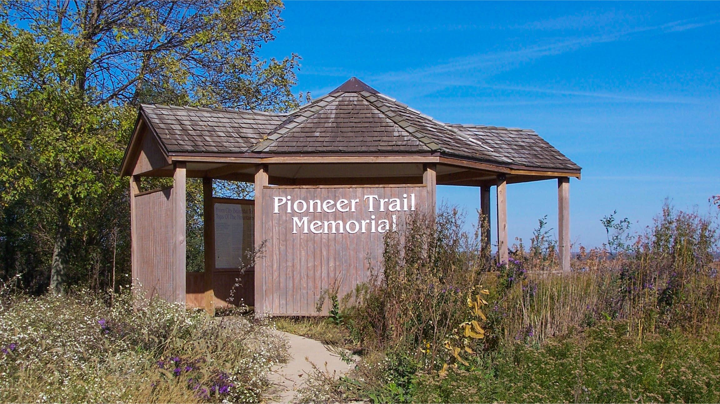
Pioneer Trail Memorial Pavilion
After the deaths of Church leaders Joseph and Hyrum Smith violence increased with attacks on outlying Mormon communities. Smith's successor, Brigham Young, eventually struck a deal to abandon Nauvoo. Mormons began leaving in January of 1846. By early autumn only about 700 Mormons remained in Nauvoo and other Mormon settlements. Many of those left behind—too poor, too ill, or too infirm to travel—were driven out by anti-Mormon raiders in September 1846. Some of these refugees found shelter and work in surrounding communities, while others congregated two miles above Montrose at the “Poor Camp.” Church leaders sent back three rescue wagon trains to move these people to places where they could spend the winter safely. Mormons who had already left sent back some wagons with provisions. Before these arrived a multitude of quail fell all along the river for forty miles in what was thought to be an act of divine favor. The “poor Camp” was deserted by the end of October.
Linger Longer Park is 3/4 of a mile north of Montrose off US-61 along the Mississippi River. This roadside park has has a Pioneer Trail Memorial pavilion with exhibits about the “poor Camp,” Nauvoo, and about the Mormon trek to Utah. Linger Longer Park is the approximate site of the Miracle of the Quail and offers a panoramic view of the Mississippi River.
Sugar Creek Historic Site
Sugar Creek Camp was the staging ground where the first group of emigrants gathered and waited for Brigham Young while preparing for their journey west. The main camp was east of the creek; later, the company also camped briefly on the west side. The Mormons departed Sugar Creek on March 1, 1846.
Sugar Creek Historic Site is directly west of Montrose, on Road J-72 (the road to Argyle.) The site is on privately owned pastureland and no traces of the original camp are visible and no on-site interpretation is provided. Please view from the road and do not enter property without owner’s permission.
Mormon Immigrants’ Camp, 1853
On April 1, 1853, a steamboat docked at Keokuk and discharged some two hundred passengers, the first of twenty-five hundred Mormon immigrants to arrive in Keokuk that spring. Keokuk had been designated as that year’s outfitting post and the camp nearly doubled the town’s population, which was 3,256 by late 1852. The campground was located north of the city limits, stretching along the bluff on open-range pasture belonging to Charles Mason of Burlington, former chief justice of Iowa Territory. The camp was described as a long street lined by wagons instead of houses. From April through July, over 2,500 mostly European Mormons formed into 10 wagon trains and headed west. While camped at Keokuk, the Mormons left a lasting mark on Keokuk, most notably by the improvement to its streets.
An interpretive panel about the Mormon Immigrants’ Camp is located at Triangle Park on the corner of 5th & Grant Avenue. Triangle Park is located in close proximity to the actual encampment site. Like the Latter Day Saints who passed through Keokuk in 1853, Mormon Historic Sites Foundation assisted the city by repairing the curbs and gutters that surrounded the park.
Visiting the Mormon Pioneer National Historic Trail
Visiting Hours
Sites along the Mormon Pioneer National Historic Trail can be visited daily from dawn to dusk.
Brochures with maps of the Mormon Pioneer National Historic Trail can be obtained at the Nauvoo Visitor's Center or
Auto Tour Route Interpretive Guides can be downloaded from the National Park Service.
There is no charge to visit the Mormon Pioneer National Historic Trail.